Tuesday, March 29, 2011

SNOW! Spring...Where Are You?!


Spring snow... I really do not like it. So, with that in mind...here are the pictures from my yard and back deck this morning. 1.7 inches of snow this morning at 7:00 AM.


Some areas of southern Iowa are reporting 3 inches of snow. That is along the Highway 34 line between Creston and Chariton.


The dry air last night was holding on so well, and the system seemed to be dying down as it moved to the south of Des Moines, I felt comfortable telling everyone that we would not see snow even in the grassy areas this morning.


The system rebuilt to the west and south and the moisture levels increased dramatically early this morning. I did expect more humidity in the air, but by the time the moisture levels increased that the little weather maker would be well past Des Moines.


Humbly, I measured the snow this morning.


On a brighter note... we will see this snow melt away very quickly today. Highs will be right around 40.


The cool 40s will stay in the early part of the 7 day forecast...but 60s are still on track for the weekend.


Spring! Yahoo!

Monday, March 28, 2011

Cool Now...Spring Temperatures Late This Week

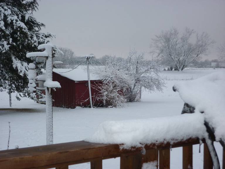
It just does not seem fair that we are dealing with the upper 30s to around 40 today after such a warm week last week. It was cool over the weekend...but by Friday we will flirt with 60 and then hit the 60s for the up-coming weekend. It should be a great start to April. Just a few chances for showers are in the forecast late tonight and early tomorrow. There may be a slight chance for flurries...but nothing sticking to the ground. The air is too dry to really allow more than a trace of precipitation through the week. I was sorry to be out of town during the severe weather last week. Here is a picture of a large portion of our tree that fell onto our fence in the backyard of our home. (Nice to start up the chainsaw on the day you get home from a family vacation.) Jeriann, Brett and Megan did a great job of keeping central Iowa safe. Next week is Severe Weather Awareness Week in Iowa. Here is a rundown of the information we will be passing along to you to keep you safe through the week. Thanks to the local National Weather Service for the details listed below. Severe Weather Awareness Week -- April 4-8, 2011 The Iowa Homeland Security and Emergency Management Division and the National Weather Service have declared the week of April 4th through April 8th, 2011 Severe Weather Awareness Week. Severe Weather Awareness Week is an annual event to remind Iowans that severe weather is part of living in our state and that understanding the risks and how to respond to them can save lives. During Severe Weather Awareness Week, the National Weather Service will promote severe-weather safety by issuing informative Public Information Statements. The highlight of the week will be the statewide tornado drill on Wednesday, April 6 2011. Tornado Test Details The FCC prohibits the use of live Emergency Alert System (EAS) warning codes for test messages. A waiver was granted by the FCC which authorizes the use of real TOR EAS/NOAA Weather Radio codes for the test. Therefore, the tornado warning test messages will be sent using the TOR code with the 1050 HZ tone alert on NOAA All Hazards Radio. 9:50 AM - Storm Prediction Center (SPC) coordinates with Iowa National Weather Service (NWS) offices about a test tornado watch for Iowa. 10:00 AM - SPC issues Test Tornado Watch for Iowa. Each Iowa WFO will issue test Watch Coordination Notification messages. Test watch will be toned and alerted on NOAA All Hazards Radio and sent through the Emergency Alert System (EAS). 10:10 AM - NWS Sioux Falls and Omaha issue test tornado warnings for their Iowa counties. 10:15 AM- NWS Des Moines and Quad Cities issue test tornado warnings for their Iowa counties. 10:20 AM - NWS La Crosses issues test tornado warning for their Iowa counties. 10:30-10:35 AM - All Iowa NWS offices issues a Severe Weather Statement to terminate the test warnings. 11:00 AM - Test tornado watch expires. If severe weather threatens on April 6th, the test will be conducted on April 7th at the same time. Severe Weather Awareness Week Daily Topics Monday - The focus on Monday will be flash flooding. Flash flooding is the most deadly thunderstorm threat in the United States. Never drive into a flooded area! On Tuesday will will discuss warning reception. Over the years, the ways to get hazardous weather warnings has changed. Today, we will focus on how to get a warning. Do you know how you get a warning? Wednesday - Today is tornado day. In 2008, 13 people died from this threat in Iowa. Do you know where the safest place is in your home or car? Thursday - This is severe thunderstorm day. Hundreds of severe thunderstorms hit Iowa each year. Did you severe thunderstorms can be as dangerous as tornadoes? Friday - Family Preparedness. Learn about family safety from natural and man made hazards. For additional information, check out our fact sheet. For additional severe safety information including links to the Iowa Homeland Security and Emergency Management's Be Ready Iowa!

Monday, March 14, 2011

Flood Safety Week


This is National Flood Awareness week. It is a topic that should be very important to all of us.

Each year more people are killed in floods than any other weather disaster. It is the killer that takes many by surprise.

Make sure you have a NOAA all hazards radio in your home and office.
Sign up for on-line alerts.
Watch Iowa's Weather Plus on 13.2. Live updates and warnings will always run at the bottom of the screen with the latest forecasts for severe weather.

Here is a great link that will keep you and your family safe.
http://www.floodsafety.noaa.gov/

Friday, March 11, 2011

NOAA Tsunami Resources Online


This amazing image is from NOAA. It shows the impact of today's tsunami.


NOAA has generated several graphics of today’s Pacific tsunami and general tsunami information. They are available at the following websites.


· High resolution wave model image: http://www.nnvl.noaa.gov/MediaDetail.php?MediaID=680&MediaTypeID=1


· NOAA Center for Tsunami Research: http://nctr.pmel.noaa.gov/honshu20110311/


· Tsunami Fact Sheet: http://www.noaa.gov/factsheets/new%20version/tsunamis.pdf


· Tsunami information portal: http://www.noaawatch.gov/themes/tsunami.php

Tsunami...Japan to Hawaii


Japan's largest earthquake in history erupted about 80 miles off shore yesterday afternoon. A tsunami swept over a mile of Japan's coast. The quake was the seventh largest on record. 8.9.

The under-water earthquake created some amazing video. It hit during the daylight hours...just before 3 PM. Check out this BBC video of the whirlpool created right off the coast.
http://www.bbc.co.uk/news/world-asia-pacific-12709856


Hawaii and the west coast of the United States was under a tsunami warning this morning. There were concerns that the large waves would damage ports/coast lines. The damage was minimal on the islands of Hawaii. The waves did push some boats under water and into other vessels in California.

A tsunami is created when an earthquake erupts under water. The force of the earthquake must be a vertical push...not horizontal. That upward force sends a ring of waves outward from the epicenter. Then the water gets sucked downward and then back up again.

The USGS has some great interactive web sites that we can use to teach and learn about earthquakes and tsunami events. Here is a link to one of their sites that starts with an eye-witness account of the 2004 tsunami that killed over 200,000 people in Indonesia.
http://www.whoi.edu/home/interactive/tsunami/


Wednesday, March 9, 2011

March Mess


March storms are some of the most frustrating. This time of the year folks are ready to break into Spring break. Ready to think about digging in to gardening...not digging out of snow.
Tuesday the rain turned to snow and pain for some. The picture is from Creston. Warren Woods had around 4 inches of snow. The snowfall total map shows reports of snow ending around 8:30 this morning.
We were glad to see the picture and have the report from Warren this morning. Creston had more snow and much earlier than the rest of the state. The southwest corner was already under snow by 4 pm Tuesday.
This storm set up right over the central Iowa area. The forecast showed more rain...not snow over Des Moines, but the cloudy skies through the day over the southwest did not allow us to hold onto the warmth of 42 that was the high for the day.
March storms have so much heat and moisture that it is a challenge to nail down the rain to snow line. It can take years off a weather forecaster...make hair go gray...right before it is ripped out of your scalp.
The great thing about March snow is the short curb-life. Highs are going to be back in the 50s by Friday.

Tuesday, March 8, 2011

Snow Starting To Stick...8:40 PM


The winter weather advisory continues for the counties in blue...the winter storm warning is still in effect until 6 am for the pink counties.


The snow is falling in the metro....sticking to the grassy areas...but leaving the roads just wet.


Slick roads are causing slow traffic west of Des Moines on Interstate 80...and south along I-35.


Highway 30 and 20 between Ames and Story City are also partially covered with slush and snow.


The rain/snow line is right on top of Des Moines. It is all rain in the southeastern 1/3 of the state. Waterloo just reported the rain changing to snow.


I am still looking for a rain to snow mix through midnight. The temperatures are staying right around 34 degrees. The dew point is 32 degrees. That means the temperature can't fall below the freezing point.


1 to 3 inches of wet snow is possible in Polk County. Heavier amounts will fall in the western portions of the county...lighter amounts in southeastern Polk.


There is still a good chance for 5 to 7 inches of snow in the Ames...Nevada...Marshalltown...Iowa Falls and Eldora areas of the state.


More updates tonight at 10 PM...blog updates through the overnight.

Wet Roads Now...Slick Later


Wet roads were common over central Iowa at 6 tonight.
We have reports of up to an inch of snow in Creston. That is in Southwest Iowa.
The snow started to fall there this afternoon. They had cooler temperatures through the day because of showers that moved into the state from the south.
Still a winter weather advisory for most of the state...including Des Moines. A winter storm watch is still in effect for the Ames...Marshalltown...Waterloo and Mason City areas.

Winter Weather Advisory for Des Moines


Winter weather advisory is in place for the counties shaded in purple. This includes Des Moines.
The pink counties have a winter storm warning.
The National Weather Service has changed up the forecast this afternoon.
I still think we will see more rain through the evening and overnight hours. There will be areas of snow to the north of Des Moines...and it could be heavy at times. But Polk County is on the rain to snow line.
There is a chance for 5 to 7 inches of snow in the Interstate 35 corridor from Ames to Mason City.
There will be a period of rain changing to snow overnight in Des Moines...but we would only see light accumulation of snow in grassy areas.
Stay tuned for our forecasts tonight....road conditions could be slick in northern Iowa.

Winter Storm Watch...Northern Iowa


A winter storm watch has been issued for the counties shaded in blue. The watch does not include the Des Moines metro area.
The fog and drizzle will continue over the central Iowa area through early afternoon. Then we will see rain starting around 3 PM.
The colder air will move through and we will see snow starting to pile up in northwestern Iowa.
Rain is expected in Des Moines through Wednesday morning. We will see about .75" of rainfall...but little snow.
The freezing line is going to stay in northwest Iowa until late this evening as the temperatures start to fall with sunset.
Roads will be slick in northwest and north central Iowa tonight through tomorrow morning.
It will be very windy Wednesday through Thursday morning.

Thursday, March 3, 2011

New Flood Outlook

The newest flood outlook was just posted from the National Weather Service.

WED JAN 26 2011
...SPRING FLOOD AND WATER RESOURCES OUTLOOK...
THIS FLOOD OUTLOOK IS FOR THE NWS DES MOINES SERVICE AREA. IT COVERS THE
TIME PERIOD FOR FEBRUARY THROUGH APRIL 2011. IT INCLUDES THE FOLLOWING
RIVERS AND THEIR TRIBUTARIES IN NORTH CENTRAL...CENTRAL AND SOUTH
CENTRAL IOWA...
IOWA...CEDAR...SKUNK...DES MOINES...RACCOON...NISHNABOTNA...
102...THOMPSON AND CHARITON RIVERS
...FLOOD OUTLOOK HIGHLIGHTS...
* THE RISK OF FLOODING FROM LATE WINTER INTO SPRING IS NEAR TO ABOVE
NORMAL. CURRENT INFORMATION SUGGESTS IT IS MOST ABOVE NORMAL ACROSS
NORTHERN PORTIONS OF THE CEDAR...IOWA AND WINNEBAGO RIVER BASINS...AS
WELL AS IN THE UPPER DES MOINES RIVER BASIN.
* THE TIME PERIOD WHEN FLOODING IS MOST LIKELY BEGINS BY MID MARCH...AND
EXTENDS INTO APRIL. STREAM LEVELS TYPICALLY BEGIN INCREASING BY MID
MARCH. A SIGNIFICANT...PROLONGED WARM-UP MAY RESULT IN EARLIER RISES ON
THE STREAMS.
* BE ON THE LOOKOUT FOR ICE JAMS...ESPECIALLY IN THE LOCATIONS MOST
PRONE TO THEM. THEY WILL BE MOST LIKELY BY MID MARCH. THE RISK OF ICE
JAMS IS NEAR NORMAL. A QUICK WARM-UP MAY RESULT IN EARLIER ICE JAMS.
* ABNORMAL TEMPERATURE AND PRECIPITATION BETWEEN NOW AND THE SPRING THAW
MAY SIGNIFICANTLY AFFECT THE RISK OF FLOODING. THIS OUTLOOK ASSUMES NEAR
NORMAL TEMPERATURES AND PRECIPITATION THROUGH THE SPRING THAW. ABOVE
NORMAL PRECIPITATION WOULD TEND TO INCREASE THE RISK OF
FLOODING...WHEREAS BELOW NORMAL PRECIPITATION WOULD TEND TO DECREASE IT.
* THE RISK OF FLOODING AND FLASH FLOODING WILL BE HIGHER THAN NORMAL
AFTER THE SNOW MELTS...AND WILL REMAIN HIGHER THAN NORMAL AT LEAST INTO
LATE SPRING. HEAVY RAINFALL MAY RESULT IN ADDITIONAL OR PROLONGED
FLOODING.
* WE WILL ISSUE OUR NEXT...UPDATED OUTLOOK ON THURSDAY...FEBRUARY 17