Tuesday, June 21, 2011

Intern Sam's Wild Tornado Chase

Our 13 HD summer intern is Sam Schreier was storm chasing yesterday in Nebraska and saw this amazing tornado move across the road right in front of his chase vehicle.
Sam said the tornado passed about 150 yards straight over the hood of their car.
Sam even had time to get out and get the pic of a life-time! Way to go Sam. Glad you are safe.

Monday, June 20, 2011

Tornado Watch Expanded To Include Des Moines


A tornado watch is now in effect for the western 1/2 of Iowa until 2 am. The new watch includes Des Moines.

We were not included in the first watch...but the storms have intensified in Nebraska and Kansas.

The best chance for severe weather still runs between 9PM and 2 AM.

Tornado and Flash Flood Watches


A tornado and flash flood watch has been issued for portions of the state tonight and tomorrow. The tornado watch is for southwest Iowa until 10PM. The flash flood watch is for central and southern Iowa until 1 PM Tuesday.

There have been supercell storms in Nebraska and Kansas today.

The College World Series is going on in Omaha tonight. There is a good chance that tornadoes and severe storms will be rolling through the Omaha area tonight.

Tornado in New Sharon


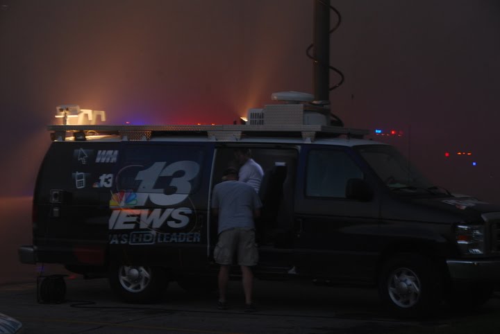
Our own Emily Carlson is in New Sharon today and took these pictures of the storm damage overnight.

The National Weather Service has a survey crew in New Sharon and says the tornado was an EF1.

We will have much more on the severe weather damage tonight at 5,6 and 10.

There is another very good chance for severe weather tonight. Follow my forecasts and severe weather updates on Twitter: @EdWilsonWX13HD.

Here is the NWS text on the tornado in New Sharon.


..PRELIMINARY DAMAGE SURVEY RESULTS FOR NEW SHARON TORNADO...

THE STORM SURVEY INVESTIGATION IS STILL ONGOING AND SUBJECT TO
FURTHER COORDINATION WITH LOCAL EMERGENCY MANAGEMENT AGENCIES

...TORNADIC DAMAGE CONFIRMED ON THE SOUTH SIDE OF NEW SHARON...

A PRELIMINARY ASSESSMENT FOR THE DAMAGE THAT OCCURRED IN NEW
SHARON ON JUNE 20 2011 DETERMINED THAT THIS DAMAGE WAS CAUSED BY A
SMALL TORNADO.

* EVENT DATE: JUNE 20, 2011

* ESTIMATED START TIME: 505 AM

* EVENT TYPE: (EF1) TORNADO

* EVENT LOCATION: NEW SHARON

* PEAK WIND: 110 MPH

* AVERAGE PATH WIDTH: 50 YARDS

* PATH LENGTH: 1/2 MILE

* INJURIES: NONE KNOWN

* FATALITIES: NONE KNOWN

* DISCUSSION/DAMAGE: NUMEROUS TREES DOWN IN TOWN WITH SOME GRAVE
STONES TOPPLED IN A CEMETERY. WORST DAMAGE OCCURRED TO A MODULAR
BUILDING THAT WAS MOSTLY DESTROYED BY THE TORNADO.

&&

FOR REFERENCE...THE ENHANCED FUJITA TORNADO SCALE CLASSIFIES
TORNADOES INTO THE FOLLOWING CATEGORIES:

EF0...WIND SPEEDS 65 TO 85 MPH.
EF1...WIND SPEEDS 86 TO 110 MPH.
EF2...WIND SPEEDS 111 TO 135 MPH.
EF3...WIND SPEEDS 136 TO 165 MPH.
EF4...WIND SPEEDS 166 TO 200 MPH.
EF5...WIND SPEEDS GREATER THAN 200 MPH.

Wednesday, June 15, 2011

Fire On The South Side of Des Moines Tonight


These are pictures from a fire near Ft. Des Moines tonight on the south side of Des Moines. The fire started around 7PM...got out of control. Looks to be a total loss. Everyone got out. Calm wind helped contain the fire to one building.

Tuesday, June 14, 2011

Warning still going until 11:30 south of DSM

A Severe Thunderstorm Warning remains in effect for eastern Decatur...Lucas and Wayne counties until 1130 PM ... At 1055 PM ...Doppler radar indicated a line of severe thunderstorms capable of producing quarter size hail...and damaging winds in excess of 60 mph. These storms were moving east at 20 mph. Locations impacted include... Chariton...Corydon...Williamson...Millerton...Lineville... Russell...Clio and Allerton. Precautionary Prepare for damaging winds...falling trees and flying debris. Move indoors and stay away from windows. If you are in a Mobile home...get out now...and seek shelter in a reinforced building.

More Updates on Severe Weather...10:45PM Warning

A Severe Thunderstorm Warning remains in effect for southwestern Marion and southeastern Warren counties until 1045 PM ... At 1021 PM...Doppler radar indicated a severe thunderstorm capable of producing quarter size hail. This storm was located 12 miles north of Chariton...moving northeast at 35 mph. Locations impacted include... Melcher-Dallas. Prepare for large hail and deadly cloud to ground lightning. People outside should move to a reinforced building and away from windows.

New Storms Just South of Metro

A Severe Thunderstorm Warning remains in effect for northwestern Lucas...southwestern Marion and southeastern Warren counties until 1045 PM ... At 1008 PM ... Doppler radar indicated a severe thunderstorm capable of producing quarter size hail. This storm was located 14 miles south of Indianola...moving northeast at 30 mph. Locations impacted include... Lacona...Milo...Melcher-Dallas and Sandyville. Prepare for large hail and deadly cloud to ground lightning. People outside should move to a reinforced building and away from windows. A Tornado Watch remains in effect for the warned area.

Severe Storm Update...

A Severe Thunderstorm Warning remains in effect for northwestern Appanoose and western Monroe counties until 945 PM ... At 930 PM ...Doppler radar indicated a severe thunderstorm capable of producing quarter size hail. This storm was moving east at 20 mph. Locations impacted include... Melrose and Moravia. A Tornado Watch remains in effect for the warned area. If a tornado is spotted... immediately move to the basement or small interior room of a reinforced building. Torrential rainfall is also occurring with this storm...and may lead to flash flooding.

Severe T-Storm Warnings Far South Iowa

SEVERE THUNDERSTORM WARNING FOR...   NORTHWESTERN APPANOOSE COUNTY IN SOUTH CENTRAL IOWA...   SOUTHEASTERN LUCAS COUNTY IN SOUTH CENTRAL IOWA...   SOUTHWESTERN MONROE COUNTY IN SOUTH CENTRAL IOWA...   NORTHEASTERN WAYNE COUNTY IN SOUTH CENTRAL IOWA...  * UNTIL 945 PM CDT  * AT 855 PM CDT...NATIONAL WEATHER SERVICE DOPPLER RADAR INDICATED A   SEVERE THUNDERSTORM CAPABLE OF PRODUCING QUARTER SIZE HAIL.  THIS   STORM WAS LOCATED 11 MILES NORTHEAST OF CORYDON...OR 19 MILES   NORTHWEST OF CENTERVILLE...AND MOVING EAST AT 25 MPH.  * LOCATIONS IMPACTED INCLUDE...   RUSSELL...MELROSE AND MORAVIA.

Severe Threat Tonight


The Tornado Watch is still in effect for southern Iowa and much of Missouri until 11 tonight. The storms are moving through south-central Iowa right now. We have a good chance for storms that will be slow moving and could produce tornadoes.
There is also a Flash Flood Watch in effect for the southern 1/2 of Iowa until 7 AM Wednesday.
Be ready for severe weather tonight. Follow me on Twitter EdWilsonWX13HD.

Still Storming Tonight

Waukee had penny skize hail....2:30 this morning.

Watch for more warnings on HD 13....and follow me on twitter... EdWilsonWX13HD

Dallas and Madison Co Warning Updates

A Severe Thunderstorm Warning remains in effect for southeastern Dallas and northern Madison counties until 200 am... At 123 am .. Doppler radar indicated a severe thunderstorm capable of producing quarter size hail. This storm was located 6 miles south of De Soto...or 21 miles southwest of Des Moines...moving northeast at 15 mph. Locations impacted include... De Soto...Patterson and Van Meter. This includes Interstate 80 between mile markers 97 and 121. Prepare for large hail and deadly cloud to ground lightning. People outside should move to a reinforced building and away from windows. Torrential rainfall is also occurring with this storm...and may lead to flash flooding. Do not drive your vehicle through flooded roadways. Turn around Don/T drown.

New Severe Storm Warning

a Severe Thunderstorm Warning is in effect for... northern Mahaska County .. southwestern Poweshiek County ... * until 200 am * at 114 am .. Doppler radar indicated a severe thunderstorm capable of producing quarter size hail. This storm was located 7 miles east of Pella...or 10 miles northwest of Oskaloosa...and moving northeast at 20 mph. * Locations impacted include... New Sharon...Montezuma...Searsboro and Barnes City. Large hail can cause injury and property damage. Seek safety indoors until the storm passes.

Severe Storm Warnings

A Severe Thunderstorm Warning remains in effect for eastern Dallas and northwestern Polk counties until 145 am ... At 110 am ...Doppler radar indicated a severe thunderstorm capable of producing quarter size hail. This storm was located near Dallas Center...or 17 miles west of Des Moines...moving northeast at 25 mph. Locations impacted include... Grimes...Perry...Woodward...Minburn...Granger and Bouton. This includes Interstate 80 between mile markers 120 and 121. Prepare for large hail and deadly cloud to ground lightning. People outside should move to a reinforced building and away from windows. Torrential rainfall is also occurring with this storm...and may lead to flash flooding. Do not drive your vehicle through flooded roadways. Turn around Don't drown.

Wednesday, June 8, 2011

Severe Storms Tonight...cooler tomorrow


These are pictures of the hail stones that fell in Ankeny tonight. During the rush hour many folks were emailing and tweeting about the hail falling over the north side of Ankeny.
There are several severe thunderstorm warnings going on tonight. Jasper...Polk...Marshall...Poweshiek were all warned.
The southeast 1/2 of Iowa is under a severe thunderstorm watch through the rest of the night.
Expect the same type of severe weather again early tomorrow morning...and then again late Thursday night and early Friday.